Current Watches
Current Watches

Current Mesoscale Discussions

SPC Day 1 Outlook

SPC Day 2 Outlook

SPC Day 3 Outlook

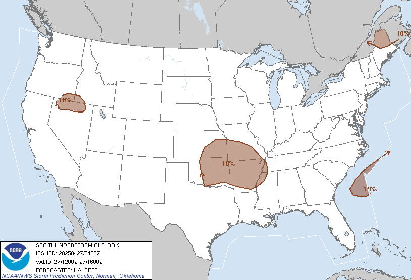
12-16Z T-Storm Outlook
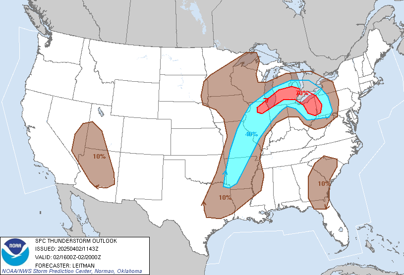
16-20Z T-Storm Outlook
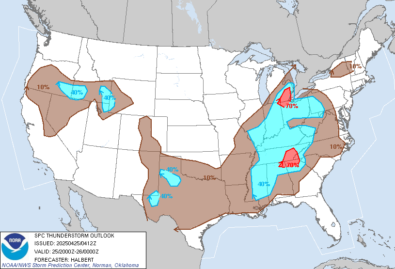
20-0Z T-Storm Outlook


- NWS Coastal Marine Forecasts
- Narragansett Bay Marine Forecast
- Rhode Island Sound Marine Forecast
- Block Island Sound Marine Forecast
- Surf Zone Forecast
General Forecasts
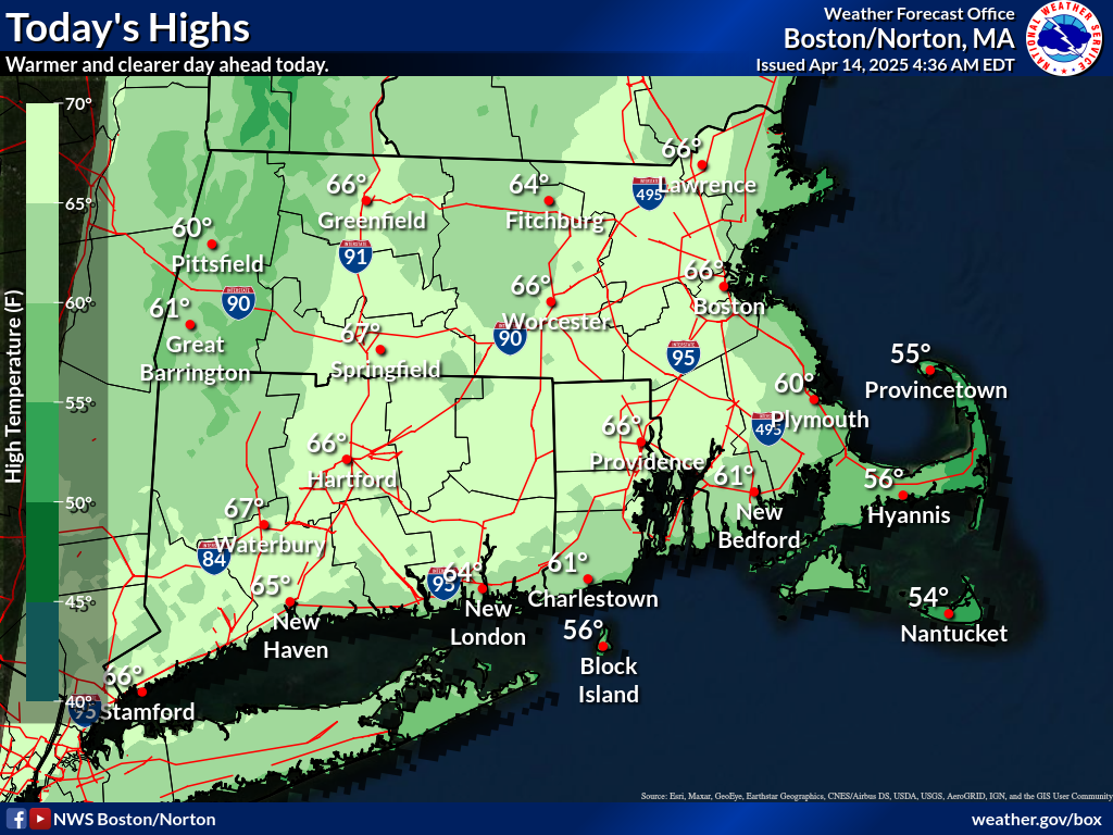
- NWS Boston (KBOX)
- KBOX Area Forecast Discussion
- KBOX Hazardous Weather Outlook
- NWS NDFD Forecast
- National Data Buoy Center (NDBC)
- Newport Tidal Station
- NDBC NWPR1 (Newport Harbor
- NDBC QPTR1 (Quonset Point)
- NDBC BUZM3 (Buzzards Bay)
- Interactive Metars
- MADIS Surface Obs
- Interactive Observations
- 4-Panel Obs-National
- 4-Panel Obs-Northeast
- 4-Panel Obs-Great Lakes
- 4-Panel Obs-East Central
- Water Level Monitoring
- GOES Satellite Viewer
- Multi-Radar Multi-Sensor
- NOAA nowCoast
- NOAA Ocean Observations
- Convective Outlooks (SPC)
- Forecast Guidance
- Interactive Imagery (SPC)
- National Satellite Images
- Surface Forecasts (OPC)
- Precip. Forecasts (WPC)
- SREF Thunderstorm Potential
- Surface Forecast (TAFB)
- Surface Forecasts (WPC)
- TStorm Outlooks (SPC)
- Wave Period & Direction Forecasts (OPC)
- Wind & Wave Forecasts (OPC)
- Wind & Wave Forecast (TAFB)
- Climate Prediction Center
- National Hurricane Center
- Ocean Prediction Center
- Storm Prediction Center
- Weather Prediction Center