Chicago Yacht Club Race To Mackinac
Weather Resources

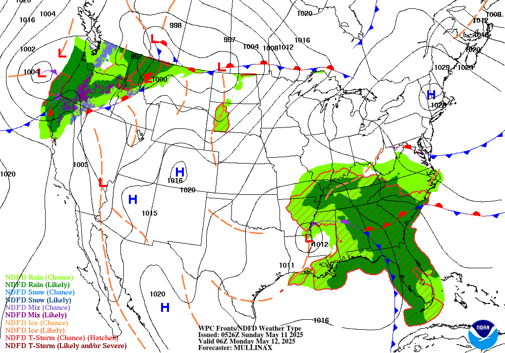
 Click on image for details.
Weather Resources
Sailing and weather are intrinsically linked. Experienced Mac sailors understand that developing a pre-race weather forecast and monitoring its evolution on the racecourse is an important strategic and safety aspect of participating in the Race. Misjudging the wind forecast can quickly send you to the back of your fleet, while failing to properly assess the risk for severe weather can unnecessarily jeopardize the safety of the crew.
- Managing Your Mac Forecast, an article on how to use the weather forecasting materials presented below. (click here)
- Chicago Yacht Club's Race To Mackinac Climatology, an article on the average marine weather conditions on Lake Michigan during mid-July (click here)
Weather Prediction Center (WPC) - Forecast imagery which shows the predicted location of high pressure systems, low pressure systems, along with their accompanying frontal boundaries. Clicking on an image opens a larger version in a new window. Click here to visit the Weather Prediction Center's home page.


The six NWS offices listed below maintain a Doppler radar station which covers a portion of Lake Michigan. Click here for a map showing the location of the radar stations.


National Weather Service - Text Great Lakes Marine Forecasts
- Offshore marine forecast for all of Lake Michigan from NWS Chicago.
- Click here for a chart of Lake Michigan's marine zones.
- NWS Chicago, IL Near Shore Marine Forecast
- NWS Milwaukee, WI Near Shore Marine Forecast
- NWS Grand Rapids, MI Near Shore Marine Forecast
- NWS Green Bay, WI Near Shore Marine Forecast
- NWS Gaylord, MI Near Shore Marine Forecast
Wind/Wave Forecasting Resources
- LakeErieWX's Lake Michigan Marine Weather Dashboard
- NWS Lake Michigan marine weather forecast website.
- Great Lakes Forecasting System from the Great Lakes Research Laboratory (GLERL):
Miscellaneous Resources
- National Weather Service-NOAA Weather Radio
- Articles related to marine weather forecasting.